The Arizona Trip - Grand Canyon and Beyond

Last year we decided to visit more National Parks in the USA. You may recall our lesson on Glacier National Park. Well, we chose Grand Canyon National Park as our next destination. To round out the trip we also included some stops in Arizona that we thought would be interesting.
We flew into the Phoenix, Arizona airport - Sky Harbor - and immediately rented a car. From there we drove north to Sedona on Route 17. Out the window we saw a rocky terrain, with many tall cactus as well as short bushes and shrubs along the highway. After a hour or so we started to gradually climb into the hills. The terrain remained much the same except that there a smaller species of cactus replaced the high cactus we saw near Phoenix. We decended into Verde Valley below, and soon after up Route 260 towards Cottonwood. Verde Valley is huge, and as its name suggests, is surrounded by high hills on its north and south sides. I hesitate to call those hills mountains because I have not seen any mention of there names in any of my maps. Next we steered onto Route 89A to Sedona, which is a bit higher in elevation that Verde Valley.
By the time we arrived in Sedona it was late afternoon, so we checked into our hotel - the Aiden Best Western. We gave the hotel two thumbs up!
Not knowing a lot about Sedona, we started to look around for a place for dinner. After rejecting all the steakhouses near the hotel, we stumbled upon Judi's Restaurant & Lounge. Judi's has a really nice interior with colorful lamps and antique furnishing placed strategially in its two distinct dining rooms. The steak I had and the pasta the wife had were both great.
The next morning we hiked up the hillside at Airport Mesa to see a 360 degree panaramic view of Sedona. Amazing! Went then drove to top of the hill to Sedona Airport Scenic Lookout, but the views from there were limited and it cost $3 to park! The locals say that this is the place to go at sunset, and I can see why, but if you are hiking in the daytime, go to Airport Mesa instead.

The next day we hiked on the Boynton Vista Trail. The reddish dirt paths contrasted with the desert green colors of the bushes and small trees that dotted the landscape. The trail leads to a rise - the vista - to which we did not climb this time. We were getting a bit hungry and tired, so we headed back.


Arguably the nicest built up area of Sedona is referred to as uptown. It is located on the northward stretch of Route 89A, which we had to take anyway because that is the road towards the Grand Canyon. We had a nice lunch at SaltRock at the Amara Resort with a view of the hills and canyon. If you go to SaltRock, drive down the resort entrance and park at the resort - there is valet parking. The resort staff will give you a golf cart ride up the hill to the main street if you ask at valet desk. Geared towards tourists, the main street is filled with small souvenir shops and restaurants.

It was getting late in the afternoon, so we had to get going towards our next destination, the sourthern rim of the Grand Canyon. Our hotel was in Tusayan, which is located outside the park. The town is surrounded by Kabib National Forest.
The next morning we drove to the Grand Canyon National Park entrance. We were greeted by a line of cars stretching back a mile or so. It took us around 15-20 minutes to get to the entrance gate. The lesson here is get in line early! Because we are senior citizens, we got a senior pass for $20, which is good for a year at any National Park.
So after we got through the park entrance, we headed straight for the Grand Canyon Visitor Center. Parking was a bit tedious, but we finally found a spot. In addition to the Visitors Center there a park store, rest rooms, and even a food truck. Most importantly, this is a hub for the park red and blue shuttle buses - which are free! There are three color coded lines, red, blue, and orange. They are very convenient, and considering that there are limited parking spaces wherever you go in the park, the buses save a lot of time that would be otherwise wasted looking for a parking spot.
Instead of stopping at visitor center, we kept walking towards Mather Point. Mather Point is only a five minute walk, and is probably the most common spot where new visitors see the canyon for the first time. Well, as many before me have said, when you first see the Grand Canyon, you are overwhelmed by its vastness, its colors, its sheer size and depth. The canyon floor is at least 4000 feet below, and so it is like you are seeing it from an airplane. We took a ton of pictures, but frankly, they do not do it justice. You have to see it in person to really feel its magnificance and splendor.


In the next couple of days we spent time hiking trails around the rim of the canyon. One nice walk was between Pipe Creek Vista and Yaki Point. Another was between Mather Point and Yavapai Geology Museum. We also took the blue shuttle bus to the Market Plaza area, where there are lodges, stores and restaurants. There are a couple of interesting spots to check out - the El Tovar Hotel and Hopi House.
The El Tovar Hotel opened for business in 1905. An architect by the name of Charles Whittlesey from Chicago was the architect. Looking at the building, I had the feeling that it had no real style that I could identify. It was not Victorian Gothic, nor a Queen Anne style, so I scratched my head about it until I read that it was conceived as "a cross between a Swiss chalet and Norwegian villa in an effort to accommodate the elite of that era," per its website. Well, I never would have guessed that!


On our final day, we started on Desert View Drive, which is Route 64, towards Page. We stopped at a few places along the way, but the one that you should definitely check out is Desert View Point. There, in addition to spectacular views of the canyon, you can climb the Desert View Watchtower, which was designed by Mary Colter and finished in 1932. The view of the canyon and desert from the top of the tower is outstanding. The interior of the tower is intriguing, with mysterious drawings and artwork from the Hopi tribe throughout. Note that in order to go up the tower, you need to get a ticket and wait in line. Only 25 people (if memory serves) are allowed to enter at a time. There is no elevator, so be prepared to walk up a couple hundred steps to the top.


Soon we were back on the road again heading east on Route 64 and then north to Page on Route 89. It took roughly two hours to get there. You'll see some dramatic scenery on the way, with red rocky hills to the right and the Grand Canyon to the left.
The small city of Page, which overlooks Wahweap Bay from Manson Mesa, was created as a by-product of the building of the Glen Canyon Dam. Basically, a town was created to house the workers and their families, and since the start of dam construction in 1956, the town has grown steadily. There are numerous sights to take in when you visit Page. We stayed only two nights, so our itinerary was a bit short, but that said we experienced the essence of Page - the natural wonders and the man made wonders too.
Our primary destination in Page was to visit Antelope Canyon, which is one of the most popular slot canyons in the western US. You can only experience the canyons via a formal tour. We signed up for one months before visiting Page. There are two portions of Antelope Canyon - the upper canyon and the lower canyon. These two are miles apart, so there is no combination tour of both of them.
The upper canyon is more suited to those who are not avid hikers, though there is a twenty minute walk to get back to the parking area. And I should note that the ride from the meeting point and the parking area near the entrance to the upper canyon was as bumpy a ride as you will ever experience, kind of like riding a wild horse. Be prepared and hold on tight!
The inside of the upper canyon is simply stunning, with light beams leaking in from the narrow opening in the ceiling that set off different shades of color on the walls and canyon floor. It was certainly worth the trip to get here! Our tour guide explained how the canyon was formed, and mentioned the recent floods that caused tour cancelations. In 1997, there was a flash flood while people were touring the upper canyon which resulted in the deaths of 12 people. Tours were halted for years after that, but then were reconsitituted with the understanding that if any weather event was even remotely possible, the day's tours would be canceled.


One of the other natural wonders to check out in Page is Horseshoe Bend, a sharp half loop in the Colorado River. The bend is in a natural canyon, so the surrounding hills provide awesome views of the river. There is a small entrance fee to get in, parking is ample, and they even have restrooms. There is a 20 minute walk to get to the edge of the canyon.


Our final must-see attraction was the man made wonder - the Glen Canyon Dam. We stopped in the Carl Hayden Visitor Center to park and take in the views of the dam. Carl Hayden was an Arizona Senator that served for over 50 years in office. He was well known for leading or backing legislation dealing with public lands, mining, and reclamation in the Western US. The visitor center itself gives you a great deal of information about how the dam was created, as well as explanations about the adjacent Glen Canyon Dam Bridge. Unfortunately, tours of the dam itself were not being conducted at the time we visited.


It was time to move on. Our next stop was Flagstaff. Flagstaff is at an elevation of 7000 feet, so you will feel the difference in weather right away. It was 10 degress cooler than Page, and very windy. We only stayed one night there, but we did get a chance to do a couple of things that may interest you.
One was an experience that was completly different from everything else we had done on this trip. We visited Grand Canyon Deer Farm. It was a bit of a drive from the center of Flagstaff, but it went fast because most of it at highway speeds on Route 40. There you can feed the deer, and see some other animals like goats, peacocks, and even a bison and a camel. I expect kids get a kick out of this place, but we enjoyed it too. Note that the deer are a bit agressive if you have a cup of deer food in your hand!


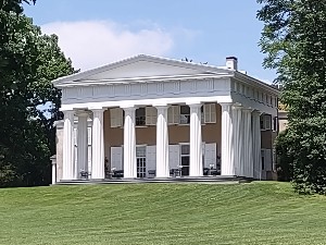
The other place we visited was in an older section of Flagstaff - Riordan Mansion State Historic Park. The Riordan family were instrumental in developing the lumber industry in Flagstaff, which effectively put it on the map. The Riordan Mansion was built in 1904 and designed in a craftsman style by the same man who built the El Tovar Hotel at the Grand Canyon. It was built as two separate residences, connected by a large anteroom known as the billiard room.
Timothy and Michael Riordan had come to Flagstaff to work for the Arizona Lumber and Timber Company, of which they eventually took over. They married the Metz sisters, Caroline and Elizabeth. So, when the mansion was completed in 1904, each family chose a wing to live in. The Riordans were given credit for the growth of Flagstaff from a lumber town to a modern city; in particular their advocacy of the Normal School, which became Northern Arizona University, was noteworthy.


Ok, it was time to make our way back to Phoenix. It was cold in Flagstaff that morning, so we got an early start. Because of that, we were able to squeeze on last thing onto our itinerary. We decided to swing by Scottsdale and see Taliesin West, which is known as architect Frank Lloyd Wright's winter home and desert laboratory. The facility and surrounding grounds epitomize Wright's design principles - simplicity, humanity, integrity, and connection. There is a rather expensive tour available at $44 that includes an app that provides you with an explanation of various points of interest on the property. We did the tour anyway, and it was worth the visit. You will not see something as unique as this original design anywhere in the world, unless perhaps you visit Taliesin East in Wisconson!


So that was the end of our big loop tour of Arizona. Feel free to drop me a note if you have any questions or would like to add anything! Cheers!


