When we started planning this trip to Yosemite in April, we wanted to stay at the Yosemite Valley Lodge like we did when we were here a decade ago, but the lodge was full, and frankly, a bit more expensive than I anticipated. So we looked outside the park for a bed and breakfast, and found a winner in the Blackberry Inn at Buck Meadows.
We rented two rooms, one for our guests, Ryuske and Mitsuko, and one for me and the wife Toyoko. So on a sunny Monday morning in late August, we hopped into our rental car and started out on the two to three hour drive from Oakland.
Rental car, you ask? Well, that is a story in itself, but I'll keep it brief. The other day the air conditioning conked out. We couldn't go up there with no air conditioning in the car as that could be dangerous because the temps were going to be in the 90's. So, I went to Enterprise Rental Car and grabbed a Mitsubishi Outlander, and we were off.
The route we chose had us going through a small town called Groveland, which is around thirty miles west of the park entrance. We stopped at the Iron Door Saloon for lunch. Established in 1852, the Iron Door perports itself to be the "Oldest Saloon in California." Fortunately the food was pretty good, with a typical saloon menu of burgers and sandwiches for the most part.
Back on the road, it only took another ten to fifteen minutes to reach our bed and breakfast. We were greeted by one of the proprieters, Alex. She and Steve have been running this beautiful B&B since 2008.
We got a nice upgrade upon arrival to larger rooms, so we unpacked the car and got everything into our rooms before venturing off towards the park at around 3pm. We decided to enter the park and drive towards Yosemite Valley, which is where the main lodge is located. The last time we came to Yosemite we stayed at the main lodge. We bought the daily pass into the park for $35, which lasts for 3 days.
Upon entering the park we basically followed the signs towards the valley. Note that WiFi is dodgy in the park, so you may have trouble using Google Maps like we did. We had a paper map of the park as well as the signs, so for the most part we navigated the old fashioned way.
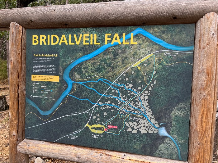
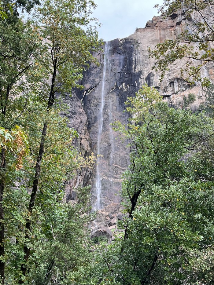
After entering the park, we followed Big Oak Flat Road (Rt 120) until we encountered a fork in the road at Crane Flat. You would turn left for Tioga Rd, which will take you to the Tuolumne Meadows, and turn right to stay on Big Oak Flat Road towards the valley. We went right, and eventually merged onto Southside Drive, which is a one way road. Near the intersection of Southside Drive and Wawona Road is Bridalveil Falls, which is a picturesque waterfall and scenic area. We parked and walked the trail to the closest point to the falls. Very cool place to hang out for a while. And, luckily, there were restrooms there too!
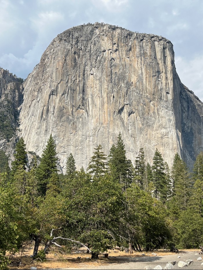
A little further up the street we stopped to take a good look at El Capitan, the enormous mountain of sheer rock to our left. Amazing that it is only 7,569 feet high - it seems higher!
It was getting late so we cruised into the valley, took a quick look at the lodge and surrounding accomodations and campsites along the way, and off we went back on Northside Drive, which is a one way road in the other direction. We wanted to get back towards the B&B to get dinner, and relax for the evening.
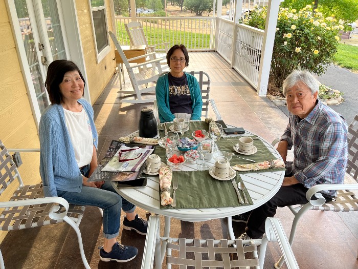
The next day we were welcomed with breakfast outside on the patio. Gorgeous! There's nothing like a sumptious breakfast and coffee to get you kick started in the morning! Today we were going to hit Tuolumne Meadows and Pothole Dome, which was recommended to us by our host Steve.
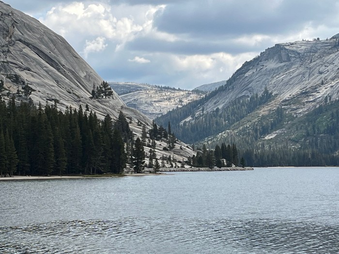
So off we went, entering the park and making our way to Crane Flat, where we made a left onto Tioga Road and up the steep side of the mountain. We made a quick stop at Tenaya Lake on the way. The expansive waterway is surrounded by rocky hills, and with the cloud formations it was really pretty.
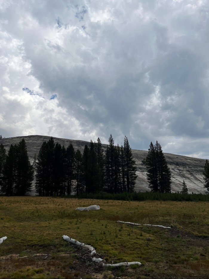
When we arrived at Pothole Dome, we noticed that the weather got suddenly cloudy. In the distance we saw what were definitely rain clouds, but we were hoping they were going in the other direction. Hoping. Ah, well, after walking no more than a minute towards the dome rain started to fall. So we fortunately decided to turn back. That was definitely the right decision, because it would eventually turn into an all out downpour. All we could do was drive to the Wilderness Center and hang out a bit. An hour later it was still raining, and the rangers said it would not clear up there until 5pm. It was only 2pm, so we decided to drive to Glacier Point. That was a steller decision.
Retracing our route back on Tioga Road, we witnessed the gradual change in the weather. It was becoming less and less cloudy, and so by the time we made it back to Crane Flat, we could see the sun! Our day wasn't totally ruined after all, whew!
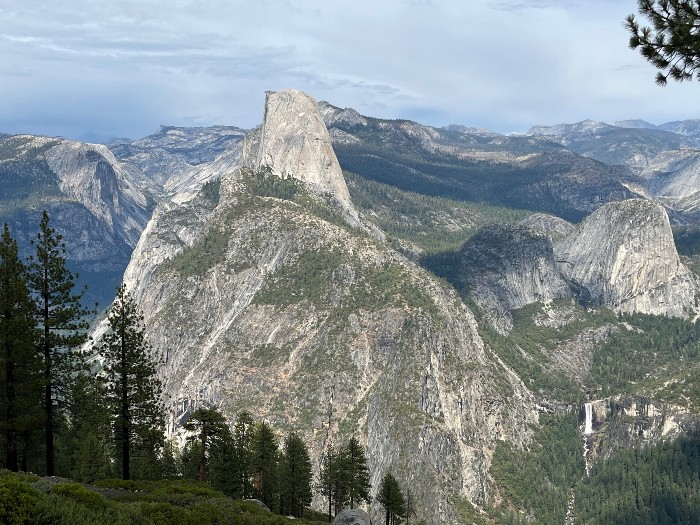
We made the turnoff for Big Oak Flat Road and proceeded towards the valley. We again navigated onto Southside Drive, and caught the turnoff onto Wowona Road towards Glacier Point. Soon after that we encountered the Tunnel View, which is an overlook over much of the park valley. You can even see Half Dome in the distance. I definitely recommend stopping for the views here.
Wawona Tunnel itself is an architectural marvel. Completed in 1933, it was bored out of solid granite, and even now is the longest highway tunnel in California.
There were a lot of twists and turns leading up the mountain to Glacier Point. We also noticed that the topology was changing a bit, from heavily wooded forests to more of a rocky landscape. We reached the Glacier Point Road turnoff after an extended bit of driving, and started a rather steep ascent, Glacier Point Road is closed during the winter, so best to check to see if it is open if you come during the off season.
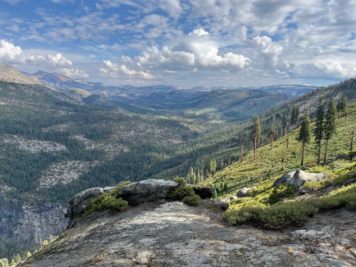
Our next stop was Washburn Point, which is literally down the road from Glacier Point. Frankly the views from here were every bit as breathtaking as the ones a Glacier Point, but that's just my opinion.
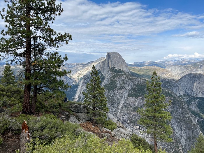
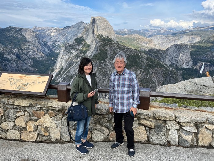
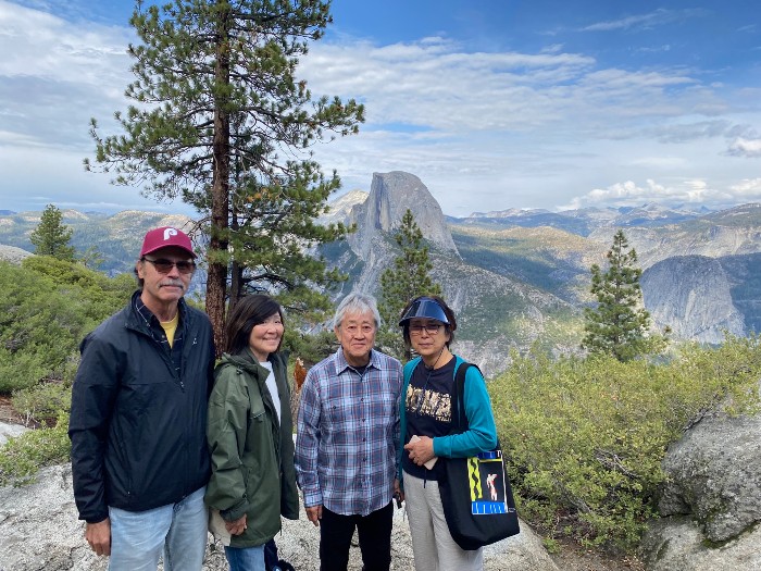
We then made our way to the Glacier Point and parked in the fairly large parking area there. Plenty of restrooms and even a convenience store of sorts awaited us. Views were spectacular from the point, and we even walked a bit on the Four Mile Trail, which is nicely laid out and maintained.
It was starting to get dark, so we began our journey back to get some dinner and some well deserved rest. During breakfast, I asked Steve what would be a good thing to check out on our way back to Oakland, and he mentioned a stop at Murphys, a small gold mining town with quaint shops and restaurants, and, Calaveras Big Trees State Park. We stopped in both places, but I won't go through much about them right now. Maybe I'll write up those in a new lesson!